Circulation Maps illustrate the long-term vision for the movement of people, goods, and vehicles within and through the former Fort Ord.
| Fort Ord Reuse Plan | ||||||
 Figure 3.5-2 Roadway Classification and Multimodal Corridor |
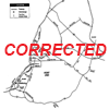 Figure 4.2-1 Existing Transportation Network, Category I Corrected |
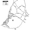 Figure 4.2-1 Existing Transportation network |
||||
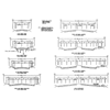 Figure 4.2-4 Roadway Design Standard |
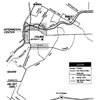 Figure 4.2-5 Transit Activity Centers and Corridors |
|||||
 Figure 4.2-7 Transportation Right-of-way Reservations |
||||||
| Environmental Impact Report | ||||||
 Figure 4.7-1 Existing Transportation Network |
 Figure 4.7-2 Proposed 2015 Transportation Network |
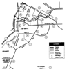 Figure 4.7-3 Buildout Transportation Network |
 Figure 4.7-4 Roadway Design Standard |
|||
 Figure 4.7-5 Proposed Bicycle Network |
||||||
